


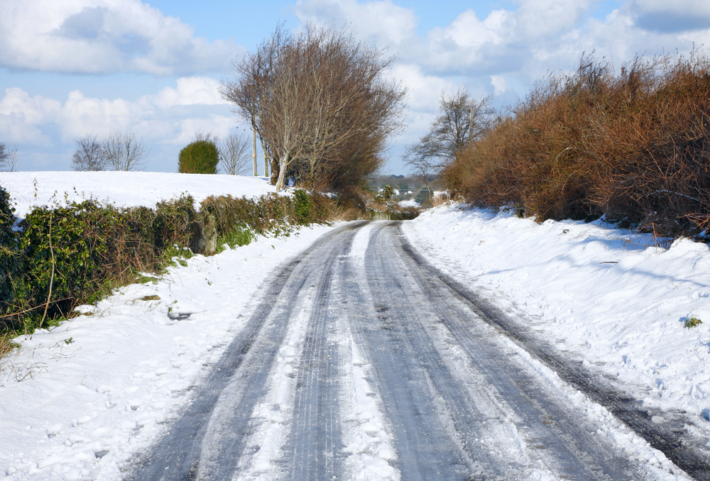
Snow and ice warning for Devon
A weather warning of snow and ice has been issued for Devon.
Showers will become frequent this evening (Thursday) and will be heavy at times, increasingly turning to snow on high ground and inland.
A longer spell of spell of sleet and snow will move southeastwards across Wales and into parts of the West Country overnight.
Snow accumulations of 1-3cm are possible above 200 metres, with some small slushy accumulations to low levels very locally.
With some of the showers falling as sleet or rain, ice is more likely to prove a hazard here where surfaces are untreated.
The wintery conditions could cause some disruption to travel and difficult driving conditions. Motorists are urged to take extra care.
The Met Office regional five day forecast is as follows:
Today:
Sunshine and showers, locally heavy and wintry for most. Heavy rain in central parts will move eastwards today, turning to sleet at times and bringing some snow to high ground. Strong winds, especially in southeastern England, making it feel cold.
Tonight:
A dry night for most with clear periods but wintry showers continuing in the north and west. Widespread frost and some icy patches forming. Breezy for most, windier near coast.
Friday:
Sunny spells in most areas, but bands of showers will move southwards through the day, turning wintry at times. Cold, very cold in the north.
Outlook for Saturday to Monday:
Mainly fine, sunny and dry, although some wintry showers possible in the north and along the east coast. Cold with widespread overnight frost and patches of freezing fog. Light winds.

 receives MAT Excellence Award for IMP Software.")